Google Earth Introduction
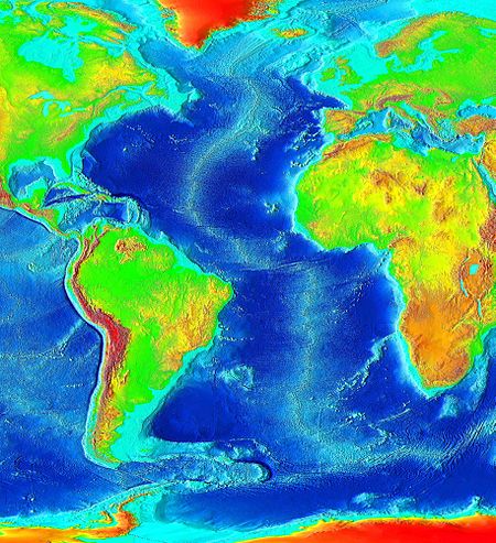
Continental Drift: Puzzle-piece
fit of the continents
This Google Earth exercise will support the Plate Tectonics Unit in Earth Science. This lesson will center on the Divergent boundary represented by the Mid-Atlantic Spreading Center. This will be beneficial once I have covered the definitions of the various boundary types. I can then use Google Earth to show the bathymetry of the Atlantic and how that is a by-product of the plate movement through time.
This presentation supports the effort of orientation so that students can see where in the world this is occurring as well as being able to see the big picture will the ability to zoom into details like Iceland.
Students will be able to use Google Earth and determine the type of boundary, recognize faults on the bathymetry, and highlight where volcanoes are located with respect to the plate boundary.
